
History and local context
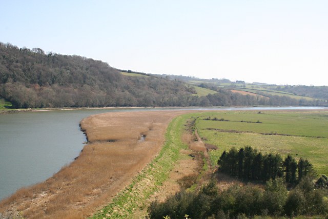
The Tamar Valley is a broad cross-border landscape shaped by the River Tamar, mining heritage, market gardens, woods and riverside settlements. It should be planned as a region rather than a single filming stop.
What it represents onscreen
The Tamar Valley supplies riverside, rural and boating landscapes used by the production, including verified Pentillie locations.
Episode and production context
Multiple series; link only to episodes with a scene-level source.
- Series 1, Episode 4: A body in a crop circle
- Series 1, Episode 5: The Three Little Pigs arson case
- Series 2, Episode 1: Murder on a steam railway
- Series 2, Episode 5: An arrow on Abbott Moor
- Series 3, Episode 1: A body on a county boundary
- Series 3, Episode 5: The Cornman farm mystery
- Series 3, Episode 6: The Devil’s Hump disappearance
- Series 4, Episode 5: The Green Man and an off-grid fire
Address
Tamar Valley, Cornwall and Devon
Visitor information
Treat this as a broad region, not a single stop. Build an itinerary around confirmed public access and realistic travel times.
Photography and best conditions
Use public viewpoints, avoid photographing identifiable private interiors, and allow for tides, weather, working activity and seasonal crowds. Early or late daylight may be quieter, but never enter a closed or unsafe area for a picture.
Accessibility
Access varies widely across stations, paths, estates and river operators. Confirm every leg separately.
Parking and transport
Parking: Use official destination guidance rather than roadside verges.
Transport: Rail, bus, car and boat options differ by destination and season.
Before you travel
- Check the official access or venue page on the day.
- Check weather, tides and flood information where the route meets the coast or river.
- Plan the return journey as carefully as the outward leg.
- Confirm toilets, rest points and step-free access for your own route.
- Do not cross closures or enter private land to reproduce a television view.
Responsible tourism
Protect paths, wildlife and riverbanks; avoid sharing directions to private or environmentally sensitive production spots.
Nearby
- Pentillie Estate
- Calstock
- St Germans
- Saltash
Sources and further reading
Last verified 27 August 2026. Recheck opening, access, transport and parking on the official site before travelling.